

ReSoiLL
Project
ReSoiLL - Resilient Soils
Living Lab
Date
2025 -
Websites
About ReSoiLL
Healthy soil is the foundation of life on Earth! It fuels our food systems, filters our water, supports rich biodiversity, and strengthens our resilience to climate change. Soil also preserves cultural heritage, shapes our landscapes, and underpins economies around the world. Protecting soils and making them more resilient means securing our future.
In 2025, the leading Forest Research Institute in Bulgaria joined forces with National Soil Survey – a company with unparalleled soil analysis and mapping expertise in the country, and Digital Spaces Living Lab – one of the leading and most experienced Living Labs in Europe, to create ReSoiLL – a new Resilient Soils Living Lab to study and pilot new sensors, technologies and best practices for creating more resilient soils in Living Lab trials in forest, urban and industrial areas in Bulgaria, the Balkans, and beyond.
What makes this new initiative truly unique, is the opportunities Bulgaria provides as a natural testbed for soil innovation. The country hosts some of the longest-running ecological monitoring stations in Europe, including Parangalitsa (since 1968), Beklemeto (since 1972), Gabra and Sandanski (both since 1980 for afforestation against erosion). These sites jointly provide over 60 years of continuous data on soil, climate, and aboveground vegetation – an unparalleled legacy that allows new technologies to be linked to robust long-term datasets, ensuring reliable validation and benchmarking. At the same time, Bulgaria still lacks a dedicated pilot initiative for testing soil resilience solutions across its diverse ecosystems – spanning forests, agricultural lands, urban environments, and post-industrial areas, making ReSoiLL a pioneering effort with broad applicability. The Living Lab also opens the door to integrating advanced robotics systems (such as SPOT robots) already used in ecological surveys, enabling automated field data collection, soil sampling, and in-situ analysis. Combined with multi-sensor data platforms like LLcloud and the development of digital twins of ecosystems, these innovations will allow researchers and practitioners to simulate, monitor, and predict soil dynamics under changing environmental and management conditions, providing a unique environment for demonstrating and refining next-generation technologies under real-world conditions.


Prof Dr Miglena Zhiyanski
Head of Forest Ecology Dept
Forest Research Institute
132 'St. Kliment Ohridski' blvd.
Sofia 1756, Bulgaria miglena.zhiyanski@fri.bas.bg

Mr Yavor Yordanov
Director
National Soil Survey
17 Hristo Botev blvd, office 519
Sofia 1000, Bulgaria
Dr Stavri Nikolov
Director
Digital Spaces Living Lab
132 Knyaz Boris I Street
Sofia 1000, Bulgaria stavri.nikolov@digitalspaces.info
About Forestry Research Institute
The Forest Research Institute (FRI) at the Bulgarian Academy of Sciences possesses long-standing expertise in soil and forest floor studies, with a strong focus on classification, assessment of macro- and microelement content, and evaluation of key physical properties. Our specialists perform precise measurements of soil carbon stocks and develop methodologies for quantifying changes over time. We integrate advanced analytical techniques with field-based monitoring to assess soil health, fertility, and resilience.
The Institute’s work also includes modeling nutrient cycling, evaluating soil-plant interactions, and studying the impacts of climate change and land use on soil functions. Our research supports the development of sustainable forest management practices, ecosystem restoration strategies, and carbon sequestration assessments at both regional and global scales. This comprehensive expertise enables us to contribute to environmental monitoring programs, policy-making, and applied projects across varied terrestrial ecosystems.
About National Soil Survey
National Soil Survey (NSS) is a research and consultancy organisation working at the intersection of agriculture and the environment, with a mission to promote sustainable land use through a deeper understanding of soil health and ecosystem dynamics. We believe that soil is not just a resource — it’s a living, vital system at the heart of environmental resilience, food security, and climate stability.
At National Soil Survey, we serve researchers, farmers, and local administrations, offering expert services in soil surveys, soil health assessment, and soil monitoring. Our work includes the design and implementation of national soil monitoring networks, GIS-based soil mapping and modelling, Ecosystem Services Mapping and Assessment, and development of tailored recommendations for sustainable land management — such as precision fertilization and crop suitability assessment. Over the years, NSS has contributed to a number of major European and National projects focused on land and soil, including long-term involvement in the LUCAS project- Land Use/Cover Area frame Survey, which provides harmonized, EU-wide data on land use and soil characteristics. Our involvement supports better environmental policy making across the continent.
About Digital Spaces Living Lab
Digital Spaces Living Lab’s mission is to improve novel products, services and apps that will change the way we live, by testing them in real-life settings and tasks in Living Lab trials. In the last 14 years DSLL has conducted over 45 large-scale product and technology validation trials for clients in the fields of smart cities, location-based services (LBS), Earth Observation, smart agriculture, mobile apps, wearables, well-being and sports, museums and art galleries, games, digital media, etc.
DSLL has helped develop and validate one of the most advanced platforms in the world for multi-sensor data analysis. LLcloud (llcloud.eu) – the multi-sensor cloud, is a cloud platform for multi-scale Earth Observation combining data from satellites, drones, UAVs, and ground-based IoT and wearable sensors. LLcloud is being used by the ReSoiLL team and partners for multi-sensor soil monitoring and analytics, fusing soil images and other data from satellites and drones with IoT and wearable soil sensor data such as humidity, temperature, chemical content (pH and nutrient levels), enabling farmers to optimize irrigation, fertilization, and overall crop management.
SOIL PROJECTS
Land-use & Management Impacts on Carbon Sequestration in Mountain Ecosystems
Duration
2013 - 2015
Project Leader
Assoc. Prof. Dr. Miglena Zhiyanski
Forest Research Institute
Funded by the Bulgarian-Swiss Cooperation Programme, this project assessed how various land-use types and management practices influence carbon storage in high-altitude ecosystems. Field measurements, soil analysis, and modeling approaches were combined to provide recommendations for enhancing carbon sequestration and maintaining soil health.
Antarctic Island Soils and
Global Carbon Balance
Duration
2019 - 2021
Project Leader
Assoc. Prof. Dr. Miglena Zhiyanski
Forest Research Institute
Funded by the National Science Fund (MES), this study evaluated the contribution of Antarctic island soils to global carbon cycling. The research involved determining organic matter stabilization and humification degrees, with implications for understanding polar carbon reservoirs under climate change.
Carbon Gain-Loss Method
Development for LULUCF SectorCarbon Gain-Loss Method Development for
LULUCF Sector
Duration
2018 - 2019
Project Leader
Assoc. Prof. Dr. Miglena Zhiyanski
Forest Research Institute
Commissioned by the Ministry of Environment and Water, this project developed and applied a model to calculate emissions and removals in Bulgaria’s Land Use, Land-Use Change, and Forestry sector. It integrated forest data collection with advanced carbon accounting methods to improve national greenhouse gas reporting.
Multi-year local partner in the LUCAS project for BULGARIA
Duration
3 consecutive campaigns (2015, 2018, and 2022), lasting 18 months each
Project Leader
Mr Yavor Yordanov
National Soil Survey
Land Use/Cover Area frame Survey (LUCAS), a survey that provides harmonized and comparable statistics on land use and land cover across the whole of the EU’s territory. Including Soil survey and sampling.
National Soil Survey was selected to organize and manage the full-scale LUCAS field survey in Bulgaria—the largest synchronized field survey in the EU. Each campaign involved visiting and monitoring more than 6,000 field points throughout the country. Along with field visits and survey of land cover and land use, a number of environmental characteristics are studied and sampled, including soil samples (bulk density, DNA samples, soil texture, soil erosion presence, contamination, etc.). Soil samples were taken from more than 1,200 locations, which were prepared and sent for analysis at the JRC. The soil samples and the description of each location were prepared according to a unified methodology proposed by the JRC.
 |  |  |
|---|---|---|
 |  |  |
Establishment & Upgrading of National Soil Monitoring Networks for Soil Degradation Processes (acidification, salinization and contamination)
Duration
2 consecutive campaigns (salinization & acidification) lasting 18 months and 1 separate campaign for contamination monitoring network 18 months
Project Leader
Mr Yavor Yordanov
National Soil Survey
Complete and in-depth review of existing monitoring stations for soil degradation processes. Analysis of data collected to date and proposal for the selection of new stations with greater representativeness. Field verification of selected monitoring stations. Development of field maps and monitoring programs, as well as GIS maps and passports for each monitoring point.
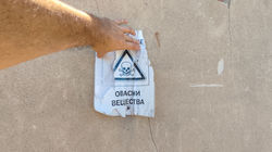
Construction and field verification of a completely new monitoring network for soil pollution, mainly from pesticides, post-production processes, post-mining activities, military activities, and oil extraction pollution.
 |  |  |
|---|---|---|
 |  |  |
 |  |
Methodological Framework for Assessment & Mapping of Ecosystem Condition & Ecosystem Services in Bulgaria
Duration
-
Project Leader
Mr Yavor Yordanov
National Soil Survey
Assessment of the health status of the soil cover under vineyards of different management types and soil affect - intensive vineyards, organic vineyards and privately managed plantations.
Establishment of a soil field survey and sampling network. Conducting a proper field soil survey. Organoleptic field assessment of soils under vines. Laboratory analysis and evaluation of soil samples. Development of a map and database of project results.
Development of a methodology for assessing and mapping ecosystem services provided by agroecosystems in Bulgaria. Testing and verification of the assessment and mapping methodology.
SOIL LIGHTHOUSES
“Parangalitsa” Reserve
Location
What type of soils are there
Cambisols
Established as a research site in 1979, “Parangalitsa” Reserve hosts long-term ecological studies in mountainous forest ecosystems along an altitudinal gradient. It is part of the UNECE ICP Forests Level 1 network, with continuous monitoring since 1987. Since 2020, it has been integrated into the national LTER-BG network, serving as a prime location for studying forest ecosystem responses to climate change. Current infrastructure includes advanced soil conductivity and temperature sensors with data loggers, meteorological stations, and systems for continuous environmental monitoring. Research topics include forest growth dynamics, carbon balance, elemental flows, biodiversity changes, and habitat quality under future climate scenarios.
 |  |  |
|---|---|---|
 |
Urban Forestry at “Arboretum”
Location
What type of soils are there
Vertisols & Anthrosol
The Arboretum of the Forest Research Institute, established in 1961, was originally designed to support scientific research, as well as the education and training of students and forestry professionals. Since 2000, it has also served as an urban forest park, providing a valuable green space for local residents—made possible by its accessible location and rich botanical diversity. Covering an area of 7.0 hectares, the arboretum is situated in the southern part of the Sofia Field, approximately 9 km from the city centre, at an elevation of 620 metres above sea level. The terrain is predominantly flat, featuring a gentle 5% slope from southwest to northeast. The regional climate is moderate continental, supporting a wide range of plant species adapted to these conditions.
The soil type in the arboretum is Anthrosol – modified Smolnik with alluvial substrates, offering suitable conditions for a wide variety of plant species and serving as an excellent base for long-term environmental studies.
The arboretum hosts around 1,500 individual trees and shrubs, representing more than 120 species and forms from 36 botanical families. Among them are 27 coniferous species from 4 families and 87 deciduous species from 30 families. Nearly half of the species are introduced, and the dendrological composition includes almost all native and acclimatized introduced species that can survive under Sofia’s local climate and soil conditions. Some thermophilic and Mediterranean species are also cultivated, requiring specific care during early growth stages.
The location and conditions in the arboretum completely replicate those of the park areas in the metropolis of Sofia and are fully representative of all urban plant species and park ecosystems. Furthermore, being within the boundaries of the Forest Institute, all solutions and innovations proposed by the team will be under constant monitoring and in a protected environment, which will ensure the security and sustainability of the research conducted and the solutions implemented.
The Arboretum is being proposed as a Lighthouse for Soil Health, designed to support cutting-edge research and applied innovation in urban tree management, sustainable irrigation, and circular resource use. The initiative focuses on developing data-driven, climate-resilient solutions for managing urban parks and vegetation.
 |  |
|---|